Apr 17, 2025·8 min
How to Build a Mobile App for Field Notes and Observations
Learn how to build a mobile app for field notes and observations: offline capture, templates, media, GPS, syncing, security, and a practical MVP roadmap.
Learn how to build a mobile app for field notes and observations: offline capture, templates, media, GPS, syncing, security, and a practical MVP roadmap.
Before you sketch screens or pick a tech stack, get specific about who is in the field and what they’re trying to accomplish. A “field notes app” for a wildlife researcher feels very different from one used by a safety inspector or a maintenance crew.
Common audiences include researchers logging observations over long periods, inspectors completing compliance checklists, naturalists recording sightings on the move, and maintenance teams documenting issues, parts used, and follow-up work. Each group has different vocabulary, required fields, and tolerance for friction.
Start by writing down the real sequence of actions during a day in the field:
To keep this grounded, watch at least one field session (or do a ride-along) and note where people pause, switch tools, or lose time.
Field work is full of constraints that should drive your design:
A strong observations tracking app is fast to capture, reliable offline, and hard to mess up. Notes should be searchable later (even across photos and metadata), and the output should be shareable without extra cleanup.
Define success metrics early—e.g., “log an observation in under 15 seconds,” “zero data loss offline,” or “export ready-to-send reports.”
An MVP for a field notes app should solve one core job: capture an observation in the field quickly, even when connectivity is unreliable. Everything else is optional until you’ve proven people will use it daily.
Before features, define the basic unit your app stores. In different teams an observation might mean a record, event, sample, or site visit. Pick one primary meaning and write it down in a single sentence, for example:
“An observation is a time-stamped visit to a location where a user records notes, selects a few attributes, and attaches media.”
This definition drives your form fields, permissions, reporting, and even how you name buttons.
Must-have (MVP): create/edit an observation, basic template fields, offline capture with reliable sync, attach photos, GPS location, simple search, and export.
Nice-to-have (later): maps with layers, audio transcription, advanced analytics dashboards, custom workflows, integrations (e.g., GIS/CRM), team chat, and automation rules.
Choose metrics you can measure in a pilot:
To ship fast, keep the first release focused:
If this MVP reliably saves observations under real field conditions, you’ve earned the right to expand.
If you’re trying to compress timelines even further, a vibe-coding workflow can help you validate the MVP faster. For example, Koder.ai lets you describe the app in chat (screens, data model, roles, sync expectations), iterate in a planning mode, and then export source code when you’re ready to take development in-house.
A field notes app lives or dies by its data model. If you get the “shape” of an observation right, everything else—forms, search, offline sync, exports—becomes simpler.
Start with a small set of building blocks:
Keep relationships straightforward: an Observation belongs to one Project, has one “primary” Location, and can have many Media items and Tags.
Beyond the note itself, capture context automatically:
Treat “draft” as a first-class status. A draft can be incomplete, editable, and excluded from official exports. A submitted record should be harder to change—ideally with an edit history or an “amended” version—so supervisors can trust reports.
Your forms will change over time. Store a template version on each observation, and keep custom-field values keyed to stable field IDs (not just labels). This enables backward compatibility: old observations still render correctly even after a template update.
Free‑text notes are flexible, but they’re hard to filter, compare, and report on later. Templates and forms give your field notes app structure without slowing people down.
A fixed set of fields works best when the workflow rarely changes (e.g., daily safety inspections). It’s faster to build, easier to test, and simpler for users.
A form builder makes sense when each project has different requirements (environmental surveys, construction punch lists, audits across clients). It also reduces app updates—admins can adjust templates without shipping a new version.
The tradeoff: you’ll need more UI work and clearer guardrails so templates don’t become messy.
Treat templates as project assets: each one defines required fields, validation, and default values.
Examples:
Also support versioning. If a template changes mid‑project, old entries should still display correctly, and new entries should use the latest version.
Provide a focused set of field types: text, numbers, picklists, checklists, date/time, signatures, and “yes/no/NA”. Keep picklists editable by project admins so teams can add new categories without workarounds.
Speed is a feature in the field:
A well-designed form should feel like a shortcut, not a chore—and that’s what drives consistent, usable data.
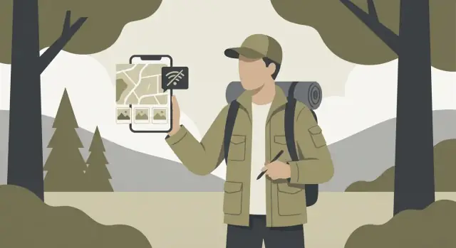
Field work rarely happens with perfect reception. Treat offline mode as the default, not a fallback. If the app can reliably save notes, photos, and locations without signal—and sync later without surprises—users will trust it.
Use a local database on the device so every note and observation is written instantly, even in airplane mode. Store new/edited records in an “outbox” queue that tracks what needs to be uploaded (create/update/delete).
Sync should run in the background when connectivity returns, but never block the user. If media files are large, upload them separately and link them to the note once complete.
Most apps need both directions:
Prefer incremental updates (since a timestamp or version) instead of re-downloading everything. Add pagination so large projects don’t time out. If you support teams, consider periodic background pulls so a user opens the app already up to date.
Conflicts happen when the same note is edited in two places before syncing. Common options:
For field notes, a practical approach is to merge structured fields automatically, and require review for the main narrative text.
Make sync visible but calm: a small status (“Saved on device”, “Syncing…”, “Up to date”), clear error messages, and simple controls like “Retry now” and “Sync over Wi‑Fi only.” When something fails, keep the note safe locally and explain what will happen next.
Location and media are what turn “a note” into a usable field record. The goal is to capture them quickly, store them efficiently, and keep them trustworthy when connectivity is poor.
When the user taps Add location, record more than just latitude/longitude. Save GPS accuracy (meters), timestamp, and source (GPS vs network). This helps you flag low-confidence points and prevents “mystery pins.”
Also allow manual adjustments. Field staff often need to place a point on a structure, trail, or plot boundary when GPS is drifting. A simple “Move pin” mode with a map preview is usually enough. Keep the original coordinates too, so edits remain auditable.
Online tiles are simplest and small on-device, but they fail in remote areas. Offline maps require storage planning:
A practical approach is to support both: online by default, with optional “Download area for offline use” for known work zones.
Keep the capture flow one tap from the note, with an immediate thumbnail so users trust it saved. Compress media on-device (especially video) and store metadata: creation time, orientation, approximate size, and (if allowed) location.
Avoid aggressive compression that ruins evidence. Offer a “Low bandwidth mode” that prioritizes smaller uploads while keeping originals queued for Wi‑Fi.
Use resumable uploads (chunked transfers) so a 30-second drop doesn’t restart a 200 MB video. Track per-file upload state locally, retry with backoff, and let users pause uploads.
For export workflows, consider bundling attachments into a single background sync job users can monitor from a simple status screen.
A field notes app isn’t used at a desk—it’s used while walking, wearing gloves, in bright sun, in the rain, and under time pressure. Your UX should prioritize speed, clarity, and “can’t lose work” behavior over fancy screens.
Keep primary actions reachable by thumb. A bottom navigation bar (or a single home screen with clear sections) is usually better than a side drawer.
Make the “add” action impossible to miss: a prominent button that opens the most common note type immediately, not a menu maze.
Small controls are a major failure point in the field:
Field users often capture a thought mid-task and finish later.
Design a “quick add” flow that can be done on one screen when possible: title/observation, optional tags, and save.
Auto-save drafts continuously and show a clear status (e.g., “Saved as draft”). If the app closes, the draft should still be there when they return.
Accessibility features also improve usability in harsh conditions.
Support screen readers, allow font scaling without breaking layouts, and ensure focus order makes sense. Use clear error messages and avoid relying on color alone to indicate required fields or validation issues.
Field work generates lots of small, messy entries—quick notes, photos, timestamps, and location points. Search and filters turn that pile into something you can actually use when you’re tired, in bad weather, and need an answer fast.
Start with full-text search across titles, note bodies, and transcribed audio (if you have it). Then add the “handles” people naturally recall:
Make results readable: show the matching snippet, the template name, and key metadata (project, date, location) so users don’t have to open five items to find the right one.
Filters are for narrowing; sorting is for priority. Common combinations that work well in an observations tracking app:
Keep filter state visible and easy to clear. A “Saved filters” option can be a big time-saver for recurring checks.
If your app is offline-first, search can’t depend on the network. Build a lightweight local index on the device (for text + key fields), update it when notes change, and degrade gracefully for heavier queries (like large-range proximity) with a clear message.
Support a few practical export paths:
Let users export a filtered set (not just “everything”), and include attachments options (links vs embedded) depending on file size and sharing needs.
Field work apps often end up holding sensitive information: precise locations, photos of private property, names, and operational details. Accounts and permissions aren’t just “admin features”—they shape trust and determine whether teams can actually deploy the app.
Offer at least two sign-in options so teams can match their reality:
Whatever you choose, avoid frequent re-logins in the field. Use long-lived refresh tokens stored in the platform’s secure storage (Keychain/Keystore), and design a clear “Lost device?” process to revoke sessions.
Start simple, then grow:
Be explicit about what happens offline. If someone loses access while disconnected, decide whether they can still view cached records until the next sync, and document that behavior for customers.
Protect data in three places:
Location data needs careful handling. Ask for location permission only when the user is about to geotag a note, explain why, and allow “approximate” or manual location entry when possible.
Finally, give teams data retention controls: how long to keep deleted records, whether to purge attachments, and what gets exported. Clear settings and plain-language prompts reduce surprises and support compliance.
Your tech stack should support fast note capture, offline use, and reliable syncing—without creating a maintenance burden your team can’t sustain.
Native (Swift for iOS, Kotlin for Android) is a good fit when you need the best performance, deep OS integration (camera, background uploads, precise location), or you expect heavy device-specific features. The tradeoff is building and maintaining two codebases.
Cross-platform (Flutter or React Native) is often the practical choice for a field notes app: one codebase, faster iteration, and shared UI components. Flutter tends to shine for consistent UI and predictable rendering; React Native can be great if your team is already strong in JavaScript/TypeScript and wants to share libraries across web and mobile.
If you’re a small team optimizing for speed, cross-platform usually wins—unless you have a clear iOS/Android-only requirement.
For the backend, keep responsibilities clear:
Offline-first apps live or die by the local database. You want strong querying (filters, full-text search), smooth migrations, and the ability to record “pending changes” for sync.
Common choices include SQLite (widely supported, flexible), or a wrapper like Room (Android). The key is not the brand—it’s whether your solution supports:
A simpler architecture—one cross-platform app, a managed database, and object storage—usually lowers ongoing costs. The “cheapest” stack is the one your team can operate confidently: fewer moving parts, clear logs/monitoring, and predictable upgrades.
If you need a starting point, document your assumptions and pick a stack you can ship with—then validate it with a small pilot before expanding features.
If your goal is to get from concept to a working pilot with minimal engineering overhead, Koder.ai can be a practical accelerator: it’s a chat-driven platform that can generate a React web app, a Go + PostgreSQL backend, and a Flutter mobile client, with built-in deployment/hosting and source code export. That makes it easier to prototype the workflow (capture → offline queue → sync → export), demo it to real field users, and iterate quickly before committing to a long custom build.
Field notes apps fail most often at the edges: no signal, low battery, and messy data. Before launch, test the app the way it will be used—outside, under time pressure, with inconsistent connectivity.
Don’t just “turn off Wi‑Fi” once and call it done. Create a repeatable checklist:
Make sure conflict handling is visible and predictable. If two edits collide, the user should understand what happened and how to resolve it.
Run the same scenarios on:
Measure battery impact during a typical day: GPS usage, camera capture, and background sync are common drains.
Add test cases for:
Ship with lightweight diagnostics: crash reporting, structured logs around sync steps, and basic “sync health” metrics (queue size, last successful sync, failed items). This turns vague field complaints into actionable fixes.
A field notes app is only “real” once it’s used outdoors, under time pressure, with messy data and spotty reception. Plan your launch as a learning cycle, not a finish line.
Start with a small rollout (10–30 people) across different roles and environments. Give testers a checklist of scenarios: creating notes offline, syncing later, attaching photos/audio, and correcting mistakes.
Collect feedback in two ways:
Tag feedback by workflow step (capture, review, sync, export) so patterns are obvious.
App stores increasingly enforce privacy disclosures. Prepare:
If a permission is optional, let the app work without it and explain what improves when it’s enabled.
Keep onboarding short: a sample project, a few templates, and “first note” guidance. Add a lightweight help center with quick tips, not manuals—think “How to log a geotagged observation in 10 seconds.” Link it from the home screen and settings (/help).
Track outcome-focused metrics: time to create a note, sync success rate, crash-free sessions, and export usage. Use these to prioritize improvements, then release on a predictable cadence. Small, frequent updates build trust with field teams more than big, rare launches.
Start by defining who is using it and the real workflow they follow in the field (quick capture, structured forms, follow-ups, exporting). Then design around constraints like poor connectivity, gloves/rain/sunlight, and time pressure. A good field app is fast, reliable offline, and hard to mess up.
An MVP should reliably do one core job: capture an observation quickly in the field, even offline, and sync it later.
Minimum set is typically:
Everything else can wait until daily usage is proven.
Write a one-sentence definition that describes the record your app stores, for example: “A time-stamped visit to a location with notes, attributes, and attached media.”
That definition determines:
Keep the model small and consistent:
Use explicit statuses:
This protects report integrity while still letting users capture partial information quickly in the field.
Make templates project-specific and versioned.
Practical rules:
This avoids breaking historical data when requirements evolve.
Treat offline as the default:
For conflicts, pick a clear rule (often: auto-merge structured fields, require user review for long text).
Store more than lat/long:
Also allow manual “move pin” adjustments (GPS drifts), while keeping the original coordinates for auditability. For attachments, use resumable (chunked) uploads and local per-file retry state.
Prioritize speed and readability:
Accessibility features (font scaling, screen reader support) also help in harsh conditions.
Support how people actually retrieve and share data:
For exports, offer and common formats like (reporting), (integrations/backups), and optional for stakeholders.
Capture metadata like created/updated timestamps, GPS accuracy, and app/device version for auditing and support.